The settlement of our region in ancient times. Summary of a history lesson "native land in ancient times" History of the region in ancient times
INVIII century BC. the first nomads who captured the steppes of the Don were tribes Cimmerians .
IN VIII-VII centuries BC. the Cimmerian war began Scythians . The Don became the far periphery of Scythia.
IN V century BC e. The Greek historian Herodotus found in the Lower Volga region an Iron Age culture and a population consisting of Scythians, who had displaced the Cimmerians who had previously lived here.
IN IY - III centuries. BC. as a result of ethnopolitical changes settled in the Lower Volga region Sarmatians - a common name for many nomadic tribes and tribal unions.
In the wide plain stretching between present-day Volgograd and the northern coast of the Caspian Sea, many tribes roamed from Asia to Europe. Passed here Huns , Khazars , aurs , Ugrians (Hungarians), Pechenegs, Cumans, Tatars and finally in XVII-XVIII centuries- Kalmyks and Kyrgyz . Some, wandering, moved on, leaving behind only graves and the ruins of ancient settlements, while others settled firmly and created their own states here.
IN mid-7th century formed Khazar Khaganate with the capital Semender, later the capital was moved to the city Itil in the Lower Volga. Gradually, the Khazar Kaganate became one of the most powerful states in the region.
IN YIII - IX centuries. our region was in the possession of a huge kingdom Khazars , which was a feudal association of semi-nomadic tribes with the capital Itil, located at the mouth of the Volga.
IN late 9th century the Khazars begin serious clashes with Pechenegs , however, their main opponent is the emerging Old Russian state .
IN IX-X centuries The young Kiev state, defending its independence, undertook a series of campaigns against the Khazar Kaganate. The decisive defeat of the Kaganate was inflicted in 60s of the 10th century, When Russian prince Svyatoslav Igorevich made a campaign on the Volga and defeated the Khazar Kaganate. Then the cities were devastated Itil , Semender , the city is captured Sarkel . The Kaganate never recovered from this defeat and by the end of the 10th century. ceased to exist.
IN XI-XII centuries vast territories of the Lower Volga and Don steppes were inhabited by numerous nomadic tribes Polovtsians , who have long roamed the vast expanses near the Volga and Don. Many pages of Russian history are devoted to the struggle of the Kyiv state with the Polovtsians.
In second half of the 13th century in the Lower Volga region a powerful Golden Horde state , whose founder was Khan Batu , grandson of Genghis Khan , who glorified himself with devastating wars against Russian lands.
TO 1240 After the capture of Kyiv, the Mongols completed the conquest of the Russian principalities, completely subjugated the Polovtsian steppe, then captured Eastern and Central Europe, China, Afghanistan, Iran, and the states of Central Asia.
One of the centers of the Golden Horde kingdom was Saray-Berke city on the river Akhtuba, where now, near the city of Leninsk, the village of Tsarev is located. Numerous cities and settlements were located here throughout the Lower Volga from Saratov to Astrakhan. The surviving maps, compiled in the 14th century, note the existence of a large city in the area of present-day Volgograd - essentially the predecessor of Tsaritsyn. One of the khan’s headquarters was located in the city, and in the place where the Church of the Baptist stood before the revolution, there was Batu’s palace. From these places the Tatars launched raids on Russian lands.
From here from the Lower Volga in 1380 began Mamai another campaign against Rus', and here, after the defeat on Kulikovo field , he was looking for shelter. Kulikovskaya battle(Mamaevo or Don Massacre) - the battle of the troops of the Russian principalities against the Horde September 8, 1380. Weakened by the Battle of Kulikovo, the Golden Horde became easy prey for the formidable avalanches of new conquerors that fell upon it. 1395 Tamerlane (Timur) ravaged the capital of the Golden Horde - Sarai and other Tatar cities and settlements of the Lower Volga region.
§ 1. Ancient history of the region
The settlement of our region by humans began in the final period of the ancient Stone Age - the Paleolithic. About 10-12 thousand years ago, the Mesolithic period (Middle Stone Age) began. On the territory of our region, the melting of the glacier, which previously covered vast territories of what is now Northern and Eastern Europe, was ending. The Arctic climate changed to a more temperate one, and the territory of the region was covered with dense forests. According to scientists, the remains of this forest area have been preserved in the northeastern part of the region (in the Krasnoznamensky district). The area adjacent to these forests was deserted for a long time, and even in the Middle Ages it was called the “Great Heath”.
The glacier retreated, leaving behind lakes and abundant vegetation. Herds of deer moved to the north - the territory of the modern Baltic states - and primitive people followed them. The rich vegetation attracted not only reindeer to these areas, but also wild boars, elk, and aurochs, so primitive people could hunt. In addition, they were engaged in fishing, gathering, and hunting waterfowl.
People used spears and darts as weapons. The action of such weapons was limited by physical
human's technical capabilities. Then bows and arrows appeared, and hunting became more effective.
Fishing was of great importance in farming. They fished with a harpoon, then they began to use nets, wicker tops, and fishhooks. Dugout canoe boats appeared.
The technique of making tools continued to improve. People learned to process wood with slate axes. Dwellings were built from wood (fallen trees, tree roots, dead wood), often near or above water, thus trying to protect themselves and loved ones from wild animals.
In the middle of the fifth millennium BC. e. The Mesolithic was replaced by the Neolithic (New Stone Age). Nature corresponded to the nature of our time. The formation of the Baltic Sea coastline has been completed.
The people who inhabited the territory of our region began to master more progressive methods of economic activity: stone processing was improved, new types of tools appeared, new methods of processing materials; the production of pottery began; weaving was invented. There was a transition from the appropriating mode of production to the producing one - agriculture and cattle breeding.
IN
Archaeological finds
Neolithic era
Neolithic period, intertribal contacts intensify, inter-tribal contacts begin first
tribal exchange, and then place-
The new population gets the opportunity to establish relations with neighboring groups of tribes, with tribes in more distant territories. Amber was the exchange material in our region. In return, local tribes received flint raw materials and other necessary materials and products.
Economic activity was facilitated by the fact that vast territories of Europe and large parts of Asia were inhabited by tribes that had much in common with each other. These were Indo-Europeans, similar to each other, speaking the same language.
Gradually, the tribes began to unite, they developed their own interests, and eventually groups of Indo-European tribes began to separate from each other. Constant movement and development of new territories contributed to the separation of groups from each other. The once common language split into a number of separate languages. The Stone Age was replaced by the Bronze Age.
A feature of the development of our region in the Bronze Age (mid-2nd millennium BC - 5th century BC) was the invasion of the Baltic territory by nomadic tribes who, along the Vistula River basin, penetrated into the Eastern Baltic and subsequently populated the forest zone of the Eastern Baltic. Europe from the Baltic Sea to the upper reaches of the Volga. They are called Baltoslavic Indo-European tribes.
Intertribal exchange increased significantly. Bronze items were exchanged for amber; the exchange involved not only close neighbors, but also more distant territories. During excavations, archaeologists find items from Egypt, Asia Minor, the British Isles, and the Caucasus. And yet stone tools still remained the main means of labor.
With the beginning of the Iron Age (from the 5th century BC), the Balto-Slavic tribes were divided into Balts and Slavs. At the turn of our era, the period of the ancient history of our region practically ended. All information about this period is based only on archaeological data.
QUESTIONS AND TASKS
Show the Baltic Sea region on the map.
What is Mesolithic, Neolithic? Describe the Bronze and Iron Ages in the south-eastern Baltic region.
Draw these periods on a timeline at the scale of your choice.
What type of activity was typical for the ancient people of our region in each of these periods?
vershi - wicker fishing tackle in the form of a funnel;
wasteland - an uninhabited, uncultivated area of land.
§ 2. The beginning of the ancient history of the region
The first written information about our region. Studying the period of ancient history is much easier. Scientists use not only archaeological finds for this, but also written sources. The first written information about our region was left not by its ancient inhabitants, but by their neighbors and other peoples who lived far from the Baltic states. Local residents did not have their own written language in those days, which is why we have to use eyewitness accounts from other regions or references to these eyewitnesses.
The Greek scientist and navigator Pytheas was one of the first to report about the Land of Amber. In the 4th century. BC e. he visited the mouth of the Vistula. According to him, one day's journey from this mouth lay the island of Abalus, onto the shores of which waves during spring storms threw amber out of the sea. Local residents used this amber as fuel and sold it to Germanic tribes. Another Greek, Eratosthenes of Cyrene, about a hundred years after Pytheas, depicted the southern part of the Baltic coast in his work Geography.
The baton of describing the ancient territory of our region was picked up by the Romans. Jewelry was very popular among the Romans in the first centuries of the new era.
10
And  from amber. They managed to organize the Amber Trade Route, which led from Rome to the mouth of the Vistula, where the amber collected by the Baltic tribes on the coast of their sea flocked. Naturally, information about the sunstone mining area began to appear in Rome.
The first scientist of the ancient world who reliably knew about the existence of the Baltic Sea and the territory where amber was collected was
Gaius Pliny Secundus, better known as Pliny the Elder. In the era of Emperor Nero (1st century AD), he wrote “Natural History”, in which he included a story about the trip of Nero’s envoy to collect amber to decorate the podium at gladiatorial games.
Analyzing Pliny's text, scientists came to the conclusion that the Roman envoy managed to get to the mouth of the Vistula, which in those distant times flowed not into the Baltic Sea itself, but into the current Vistula Lagoon. The Roman merchant spoke about the Vistula Spit, the Curonian Lagoon and the Curonian Spit. Thus, Pliny was able to describe, from the words of an eyewitness, the Land of Amber, located in the western part of the modern Kaliningrad region.
It was possible to present a very accurate geographical picture of the south-eastern Baltic region with everyday details at the turn of the 1st-2nd centuries. n. e. Cornelius Tacitus, Roman writer and historian. Talking about
tribes on the “right” shore of the Suevian Sea, he mentioned the Aestians, who created a culture that became the predecessor of the culture of the Prussians on the territory of our region. For us, Tacitus’ message is especially interesting in the sense that the Aestii he mentioned lived on the peninsula, which later received the name Sambian. The Aestian tribes occupied this territory until the middle of the 1st millennium AD. e. (there is information about their presence on the Sambian Peninsula in later times).
The ancient Greek scientist Claudius Ptolemy, a contemporary of Tacitus, presented a description of the boundaries of the territory of the south-eastern Baltic in his “Geography”. He called this land European Sarmatia, which was limited in the north by the Sarmatian Ocean and from the mouth of the Vistula extended east to the Western Dvina River. I Around 880-890. The traveler Wulfstan, who sailed across the Baltic Sea from Schleswig to the Vistula Lagoon, described the vast land of Estland, in which there were many settlements, each of them was headed by a leader, and they often fought among themselves. In the middle of the 10th century. The Arab trader Ibrahim ibn Yaqub visited our area and left a message about the life and way of life of the local population.
Finally, the most detailed description of the ancient Prussian land, the life and customs of its inhabitants at the turn of the XIII-XIV centuries. compiled by the chronicler of the Teutonic Order, Peter of Dusburg.
Settlement of the territory of the south-eastern Baltic
Resettlement of peoples in the Baltic states. In the 4th century. n. e. The Huns crushed the power of the Gothic state. Freed from the influence of the Goths, the Slavs concentrated in the Northern Black Sea region. But the constant invasions of the Pechenegs, Bulgars and other peoples forced
12
whether the Slavs looked for new places of settlement. In the VI century. they began the resettlement. Over the course of two or three centuries, part of the Slavic tribes, moving from the Danube to the north, entered the area between the Oder and Vistula rivers, displacing the Goths and forming a border with the possessions of the western Baltic tribes. Another group of Slavic tribes settled north towards Lake Ladoga. This caused them to conflict with the eastern Baltic tribes, who essentially found themselves in the way of the Slavs. The Eastern Baltic tribes were forced to concentrate on the territories of the future Lithuania, Latvia and Belarus. So the Baltic tribes found themselves between two streams of Slavs.

13
The Goths, leaving for the southern regions of Europe, took with them some of the peoples from the southern and southeastern Baltic states. Along with the Goths, the Aestians also left. Some of them then returned, but the previous culture became impoverished. Together with the Slavs, other tribes came to the shores of the Baltic Sea. There was a renaming of tribes, cultures, and geographical terms. This is how the Prussians appeared on the territory of our region.
The Prussian tribes, in fact, inherited territories already inhabited by the Aestians. Scientists admit that after some time some of the Aestii could return home. In the occupied territory, the Aestians were assimilated by the Prussians. And although the traveler Wulfstan also mentions the Aestians who lived in the Truso region (near present-day Elbląg), it is generally accepted that Prussian society and its culture arose in the second half of the 1st millennium AD. e. in the south-eastern Baltic.
Tribal structure of the south-eastern Baltic in the 10th century.
For the first time, the “Prussians” were reported by a geographer from Bavaria, whose name remains unknown in history. Bavar-

The Russian geographer indicated that these people live east of the Vistula River.
Indeed, initially (until the 9th century) “Prussians” was the name given to one of the western tribes between the Vistula and Neman rivers. But later this name became general for other tribes. “Prussia” as the name of the country of the Prussians in the 10th century. appears in the correspondence of the Pope. For example, the land of Prussia was indicated, behind which Russia was located. In the future, the term “Prussians” will appear in European and eastern medieval sources, denoting the population living between the Vistula and Neman rivers.
The origin of the term “Prussians” has no clear interpretation. There is a version about its Lithuanian roots, from protas - mind. It is suggested that this name could have been received by the Prussians from the Goths: Gothic. prus - horse (in Old Church Slavonic, by the way, prus - mare). German scientists claim that the Prussians are the people who lived along the Russ (as the lower reaches of the Neman River were called until 1945) or the people who lived before the Russians. The latter point of view is widespread in medieval sources, where the meanings of Russia and Prussia are used in conjunction: Russia - Borussia, Russia - Prussia, etc.
Questions
When and where does the first information about the territory of our region appear?
Why do you think not only scientists, but also people of other professions report on the territory and population of the south-eastern Baltic?
15
3. When did the Prussians appear on the territory of our region?
Roman historian Cornelius Tacitus about the population of the southeastern Baltic states:
“So, the right bank of the Suevian Sea is washed by the land of the Aestian tribes, whose customs and appearance are like those of the Suevi, and whose language is similar to the British. They worship the mother of the gods and wear the image of wild boars as a symbol of their beliefs. This is their protection from everything, replacing weapons, guaranteeing the worshiper of the goddess safety even among enemies. They rarely use iron weapons, but often clubs. They work on bread and other fruits of the earth with more patience than is consistent with the usual laziness of the Germans. They also search the sea, and they alone collect amber on all its shallows and even on the shore itself. But what is its nature and where it comes from, they, being barbarians, do not seek out and do not have accurate information about it. He even lay with them for a long time among other scum of the sea, until our passion for luxury created fame for him. They themselves do not use it at all. It is assembled in rough form, brought without any finishing, and they receive payment for it with surprise.”
QUESTIONS TO THE SOURCE
Why did the Aestians rarely use iron weapons?
Why do you think the Estii farmed “with more patience” than their neighbors?
Why didn’t the ancient inhabitants of the region process amber for sale themselves?
assimilation - the merging of one people with another with the loss of one of these peoples of its language and culture.
§ 3. Pagan Prussia
ABOUT  social structure. The basis of Prussian society was the community. In its form it was an agricultural (neighboring, territorial) Community. She is
from one or more
settlements (villages). A community could have up to 12 households, or householders. The head of the community was the headman or elder.
A group of communities made up a volost. The volost administrative center could serve as a fortified settlement (fortified settlement), in which a representative of the local nobility lived, who ruled the district, and which was used as a shelter for the population in case of danger.
The volosts were united into territorial units - lands. Each Prussian land was governed by a council of nobility, among which by the middle of the 13th century. particularly powerful clans stand out (Vida in Warmia, Sklodo in Sambia, Monte in Natangia, etc.). The Prussians did not develop a tradition of hereditary rule. The only attempt by Hercus (or Henry - according to other sources) Monte to unite the military forces of several Prussian lands in the fight against the Teutonic invasion failed. The military leaders, whom the chroniclers of the Teutonic Order identify as part of the nobility, did not have time to advance to the first positions in Prussian society due to the fragmentation of the lands at the beginning of the conquests of the crusaders.
The power of the councils of the nobility and military leaders was largely limited by the power of the priests. Zhre-
ts  They led the religious and social life of the Prussians, acted as judges in cases of inheritance and boundaries of property, tried criminals, and considered family disputes.
On the territory of Prussia there was an active process of differentiation of society. By the 13th century. Three social groups were distinguished: nobility, free Prussians and slaves. The nobility consisted of rich Prussians, Prussians of noble birth and kunings (princes). Free Prussians, united in communities, were, as a rule, very poor people.
By the 13th century. community members are stratified into free and dependent (compare: in Ancient Rus' such a stratification occurred in the 11th century - stinkers and purchases appeared). Changes are also taking place among the nobility, which in the German tradition is called “nobility.” Representatives of the service nobility - vigilantes - stand out here.
Religion. The ancient Prussians were pagans. The chronicler of the Teutonic Order, Peter of Dusburg, reported that the Prussians “revered all nature instead of God, namely: the sun, moon and stars, thunder, birds, also four-legged animals, even the toad. They also had sacred forests, fields and rivers, so they did not dare to cut down trees, or plow, or fish in them.”
Places of worship were sacred groves. The Prussians had well-developed ideas about the afterlife. The afterlife seemed to the Prussians to be a mirror image of the living. The path to this world lay through the funeral pyre. At the same time as the deceased, household equipment and specially prepared victims were burned in the fire.
“It happened that with the dead... weapons, horses, servants and maids, clothes, hunting dogs and birds of prey, and other things related to military affairs were burned. With the common people, everything related to their occupation was burned.”
Peter of Doesburg
The funeral cult was carried out by special priests who supposedly observed a picture of the transition to the afterlife invisible to mere mortals. Krivé played the main role among the priests. He lived in the Romove sanctuary. There was also a sacred oak tree, near which a fire was constantly burning.
G  The most important among the Prussian gods was Okopirms - the god of heaven and earth, the almighty. He is followed by the god of light Zweigstix and the god of the sea Outrimps. On the next level there were three more gods: Perkunas, Patols and Potrimps. Perkunas is the god of thunder, lightning, rain, a stern middle-aged man with a curly black beard. Patols is the god of the underworld and death, an old man with a large beard, covered with a scarf. Potrimps, the god of rivers, springs and fertility, is, on the contrary, a young man wearing a wreath of ears. The triad of gods (Potrimps, Perkunas and Patols) in the minds of the ancient Prussians symbolized the spatial model of the world (heaven - earth - underworld, OR the underworld) in unity with time in
various stages of the life cycle (adolescence, maturity, old age). The evergreen oak in the Romove sanctuary was divided into three parts, in each of which there was a window with the idols of Perkunas, Patols and Potrimps. The sacred fire was burning in front of the idol of Perkūnas.
The lower level of the pantheon was occupied by spirits and demons. The most famous of these is Kurke, the fertility demon, whose image the Prussians made and worshiped once a year at harvest.
QUESTIONS
What was the Prussian community like?
How was the community governed?
Why did the priests have the highest rights in the hierarchy of power?
Why do you think the Prussian tribes were unable to create their own state?
“One cannot think that Prussia has always been fragmented into many rural communities. Tradition says that the Scandinavian Goths, having landed in the 6th century. to the Prussian coast, found here Ulmerugiev, a mixture of Rugians, Goths and Germans. The Goths conquered them, taught them to build houses and explained to them many useful things. Soon the winners and losers united and decided to elect one leader. Pruten, a man of excellent intelligence and universal reputation, was elected king. But Pruten announced that he had decided to devote his life to the gods and offered his brother Videvut in his place. Videvut was elected king, and Pruten moved to the class of priests...
Videvut had twelve sons, who, before the death of their father, quarreled over the future inheritance. Their disagreement threatened a terrible civil strife. Then Videvut and Pruten, reasoning among themselves, decided to convene the people under the oak of Romove and declare to them the will of the gods to divide the entire earth.
Twelve sons of Videvut: Litvo, Samo, Sudo, Nadro, Shalavo, Natango, Barto, Galindo, Vareno, Goglo, Pometso, Kulmo - were called in turn under the great oak tree, took an oath to be faithful to the gods, submissive to Kriva, and in agreement with each other. Each was assigned the boundaries of a province that would be given to him by division: Lithuania received Lithuania, Samo - Sambia, Sudo - Sudovia, and so on. The names of these provinces have mostly survived to this day. According to this legend, Lithuania was once part of Prussia, which is not surprising, since the ancient Prussians and Lithuanians had the same religion, the same language, and the same morals.
Litvo, who killed his brother Nadro, was expelled from the society of the sacred oak of Romove. Irritated by this punishment, he established a special Romovo in his possession and thus separated it from the union of eleven lands.
Pruten and Videvut, having divided the land, convinced the people to honor the gods, observe the laws and not divide. Then, dressed in a festive dress and crowned with oak wreaths, in sight of the people they climbed onto a bonfire placed near the sacred oak tree, embraced brotherly and sang hymns until lightning lit the bonfire. Both elders disappeared in flames under the sound of thunder.
This is how an ancient legend talks about the division of the country. With the death of Videvut, the Prussians no longer had a common king.”
QUESTION TO THE SOURCE
Try to explain why the brothers Videvut and Pruten voluntarily gave up leadership of the country.
REMEMBER NEW WORDS
differentiation of society- division, dismemberment of the whole society into various parts, forms and levels; nobility- Prussian nobility;
triad- a unity formed by three separate parts or members;
pantheon- unification of gods on some basis; idol- statue of a pagan deity.
§ 4. Daily activities of the Prussians
IN  farming. The basis of the Prussian economy to the beginning XIII V. was agriculture. They had an almost complete set of agricultural tools (an iron ploughshare, a sickle, a pink salmon scythe, etc.), a new harness, and winter rye became the leading crop in agriculture. Such changes were typical of the Baltic states during the Viking Age. In addition, the Prussians sowed oats, barley and wheat, grew flax, were engaged in gardening, beekeeping, especially in the eastern regions, where there were huge forests, fishing, and also, possibly, sea hunting for seals.
Scientists claim that the Prussians bred horses in large numbers, whose meat they used for food, as well as cattle and pigs. At the same time, according to archeology, in forest areas the Prussians hunted primarily moose, as well as fur-bearing animals, especially black marten and beaver.
Simultaneously with the development of agriculture and cattle breeding at the turn of the 1st-2nd millennium, crafts were actively developing: iron smelting, bronze casting, ceramics, weaving, wood and bone processing, etc. However, a complete separation of crafts from agriculture did not occur.
Trade. Trade relations received special development in the middle of the 1st millennium AD. Large shopping centers appeared in Prussia around the 600s. One of these centers was Truso, near today's Elbląg (Poland).
"Amber Roads" in the X-XII centuries.
After the fall of Rome, trade, although it decreased, did not stop. Both in the 5th and 6th centuries. the “amber routes” continued to be used, through which goods from


Bargaining in the country of the Eastern Slavs. Painting by S. Ivanov
from the south-eastern Baltic states fell into the countries of Central and Southern Europe. This is evidenced by numerous Roman-Byzantine coins found by archaeologists in our region.
But encouraged in the 6th century. the amber trade was soon disrupted by the invasion of Bohemia and Moravia by the Eastern Slavs and the movement of Germanic tribes to the east and south.
In the X-XII centuries. The Vikings (the Prussians had not yet developed their own merchant class) were actively trading in Prussian goods with the inhabitants of the eastern part of Europe, the Swedes, and the Russian principalities. Along with amber, furs became increasingly important.
“They [Prussians] have strange furs in abundance, in the smell
whose pride is connected with death. But they themselves give them no more attention than waste, although we, rightly or wrongly, passionately desire to possess them as a symbol of achieving the highest happiness. Therefore, they trade their absolutely priceless marten furs for woven garments called faldone.”
Adam of Bremen, 1075
Prussian dwellings. The dwellings of the ancient Prussians were built mainly from wood, sometimes using stone (as a foundation). Naturally, these buildings themselves have not survived. However, during archaeological excavations, remains of foundations and even parts of walls are discovered, which make it possible to reconstruct the entire structure.

Thus, at the turn of the 1st and 2nd millennia, in the territory between the Vistula and the Niemen, frame wooden buildings were common, rectangular in plan, ranging in size from 3.5x3 m to 5.6x4.4 m. The frame was placed on masonry stones, which formed a kind of foundation. Brushwood or thin poles were woven into the wooden frame, which were then coated with clay. The ceiling of the dwelling was horizontal and also covered with clay. Inside the dwelling there was a round hearth, which was a ring or oval of cobblestones up to 1 m in diameter.
The floor in the room was earth- Construction
Noah. Equipped for sleeping Prussian home
wooden bunks covered with animal skins. There were pits in the room for storing food and household items. Near the house, auxiliary rooms were equipped for storing grain; most often these were also pits with ceilings made of tree branches. Cattle were kept in pens or simple stables.
Archaeologists also report buildings buried in the ground.
Life and customs of the Prussians. Legends have conveyed to us that the ancient Prussians were “tall, with blue eyes and a bright blush on their cheeks.”
Men did not cut their hair, wore beards, and dressed in white caftans that reached to the knees, but did not cover either the neck or chest. The belts were decorated with metal plaques, amber circles and copper pendants, and fastened with metal buckles.
Rich Prussians wore necklaces and other jewelry made of gold and silver. Shoes were made from leather or tree bark. The costume was completed with a fur or cloth peaked hat.
Women wore long linen dresses of different colors; their shoulders were covered with a mantle-like cape. Metal necklaces, various bracelets, amber beads, as well as all kinds of chains, rings, etc. were widely used.
The Prussians did not know the alphabet. They had no idea about chronology and did not know writing. The time of the holidays was determined by notches on the tree and other conventional, but understandable signs for them.
“The Prussians had no concept of God. Since they were fools, they could not comprehend Him with their minds, and since they did not have writing, they could not contemplate Him in Scripture. At the very beginning, they were very surprised that someone, while absent, could explain his intentions in letters.”
Peter of Doesburg
Prussian society was patriarchal. The Prussian man enjoyed unlimited power in the family. He controlled the lives of his family members; he could kill his son or daughter if he believed that they were superfluous in the family. Inheritance of property went only through the male line. The woman was completely powerless. She was bought, she could not share a meal with a man at the same table. A Prussian was allowed to have three wives. The bride price was large. Therefore, the Prussians preferred to marry women captured in military raids.
questions
Why did agriculture for a long time remain a more preferable type of farming for the Prussians compared to cattle breeding?
Why didn't the Prussians use stone to build houses?
How did the Prussians arrange their homes?
What did the Prussians look like and what did they wear?
On Idolatry and Rituals And Prussian morals:
“No one among them (Prussians. - G.K.) it is not allowed to beg; the beggar walks freely from house to house and eats whenever he wants without a twinge of conscience. If they commit murder,
27
ties, then reconciliation occurs only after the murderer or his loved one is killed by the relatives of the murdered person. When, by unexpected circumstances, they encounter insurmountable difficulties, they usually commit suicide. They had neither distinction nor counting of days. That is why it happens that when a time is set for holding a meeting or negotiations among themselves or with foreigners, then on the first day one of them makes a notch on a tree or ties a knot in a cord or belt. On the second day he adds the second sign again, and so on one by one, until he reaches the day when this agreement must be concluded again. Some of them go to the baths every day as a sign of honoring their gods, while others do not recognize the baths at all. Men and women must spin, some must spin flax, others must spin wool... Some do not dare ride black horses, others white or other colors because of their gods.”
From medieval chronicles
QUESTION TO THE SOURCE
What positive qualities of human character are discussed in this document?
REMEMBER A NEW WORD
ploughshare - the cutting part of the plow.
§ 5. Prussia and its neighbors
Territorial division. TO the beginning XIII V. in Prussia there were eleven lands: Skalovia, Nadrovia, Sambia, Natangia, Warmia, Barta, Pomezania, Pogezania, Galindia, Sudavia (Jatvingia) and Sassovia (Lubavia). Some of these lands were located on the territory of modern Poland and Lithuania, the other part - on the territory of the modern Kaliningrad region. The boundaries of the location of these lands and
28
the tribes living in them are determined conditionally on the map.
29
Prussian lands in XIII V.
Thus, the borders of Natangia extended from the Alle River in the east to the Gurovsky Heights (Poland) in the south, almost

The most numerous were Sambians. They occupied the entire Sambian Peninsula to the Pregelya River in the south, neighboring the Natangs, to the Deima River and the present village. Znamensk in the east.
In the area of today's Chernyakhovsk XIII V. lived firewood. The territory of Nadrovia occupied the basin of the Pregel River, extending in the west to the possessions of the Sambians, in the east - to the Pissa and Angrapa rivers, in the south - approximately to the border with Poland.
A significant territory was occupied Skalovy. Skalovia was located in the east of Prussia, lying on both banks of the Neman River in its lower reaches to the Curonian Lagoon. The center of Scalovia was a settlement in the area of the present city of Neman.
Finally, one of the most famous Prussian tribes - Sudava(in ancient Russian chronicles - Yatvingians) was the easternmost tribe of Prussia. Sudavia was located in the territory from the Great Masurian Lakes (Poland) to the Neman River.
It is also possible that on the territory of our region in the area of the Lava River, when it crossed the Polish-Russian border, people once lived barts.
Neighbors of Prussia. TOXIII V. the Prussians, like other Baltic tribes, did not have their own state. As a result, the territory of the south-eastern Baltic was exposed to its neighbors, who were socially at a higher stage of development.
The main danger for the Prussian tribes was their neighbors from the southwest - Poles. Over time
Execution of Adalbert by the pagans

no education in the 10th century. The Polish state did not stop trying to extend its influence over the Prussians. And since the Poles were Christians, they considered it their duty to convert their pagan neighbors to their faith. The Poles turned to their western neighbors for help, and they responded. So, in 997, the Prague preacher Adalbert, who arrived from Poland, landed on the Prussian coast. However, his mission was unsuccessful; he was killed by the pagans. According to some reports, the place of Adalbert’s death is located in our region, not far from the city of Baltiysk.
A few years later, the Roman monk Bruno tried to repeat Adalbert’s mission. But he too suffered the same fate. There were no people willing to introduce the Prussians to Christianity after the martyrdom of two missionaries.
Over the next two centuries, Poland tried to conquer Prussia. The Poles made a number of campaigns into the country of their neighbors, capturing rich booty, but the Prussians did not remain in debt. Their horse squads constantly plundered the possessions of the Polish princes in the Vistula region.
When the princes realized that they could not protect themselves from the attacks of pagan troops, they turned to the knights of the Teutonic Order for help. The Order willingly responded to the Poles' proposal, came to Prussia, conquered the local population and remained here for a long time.
 The eastern neighbors of the Prussians were related Lithuanian tribes aukštaytov And Samogitov. Being at the same stage of development as the Prussians, the Lithuanian tribes managed to unite and create their own state, which successfully resisted German aggression. But the Lithuanians were unable to help their relatives in Prussia.
Viking 7th century
In the west and north-west, Prussia had no land border. Across the sea, its neighbors were the inhabitants of Scandinavia. From 736 to 1066, the Scandinavians pursued an active policy of conquest. In Europe, the Scandinavians were called Normans, in Ancient Russia - Varangians. They called themselves Vikings. In the 10th century The Vikings formed the trade and craft settlement of Kaup (Mokhovoye village, Zelenograd region) on the Sambia coast.
The appearance of such a settlement was directly related to the development of European trade. Operating in the 8th-9th centuries. The trade route from the Baltic to the Caspian Sea and further to the Arab East was after some time replaced by the route “from the Varangians to the Greeks.” Byzantium became the main trading partner of the Baltic merchants, which in turn took over the trade in goods from the East. The settlement of Kaup thus found itself directly on the trade route connecting the Baltic and Mediterranean.
At the turn of the X-XI centuries. Clashes between the Yatvingians and residents began ancient Russian lands. Russian princes, like the Poles, tried to establish a con-

Rus IX-X centuries.
troll over the Prussian tribes closest to them. The first chronicle news of the military campaign of the Kiev prince Vladimir against the Yatvingians dates back to 988. This caused active resistance of the pagans and their raids on the Russian principalities. Under Yaroslav the Wise, a number of fortresses were built in the upper reaches of the Neman, intended to protect against the Yatvingians. But, judging by the chronicles, the Yatvingian raids until the middle of the 13th century. constantly disturbed the western borders of Ancient Rus'.
At the same time, Russian cities, along with European ones (for example, in Hamburg, the fur of the black marten mined in Prussia) also fell into the orbit of the Prussian trade activities. Prussian goods are traded in Smolensk, and in Novgorod, according to chronicles, in the 12th century. there was even Prusskaya Street. Prussia was still famous for its furs and could compete with the Russians with this product

Warrior of the 13th century.
merchants In addition, Prussian merchants began to participate in trade exchanges, supplying iron, salt and woolen fabrics purchased in European cities to the east.
QUESTIONS AND TASKS
1. What Prussian tribes are about
lived in our region? Show their places of settlement on the map.
2. Why did the Prussians have conflicting relations with most of their neighbors at the turn of the 1st and 2nd millennia?
3. Show on the map the trade routes “from the Varangians to the Khazars” and “from the Varangians to the Greeks.” Using the knowledge gained from studying the history of Russia, tell us why in the 10th century. there was a change from one trade route to another.
On the diversity and strength of the Prussians:
“There was hardly one of these nations that did not have two thousand cavalry and many thousands of warriors for battle. Rich and populous Sambia could have 4 thousand cavalry and 40 thousand warriors. The noble ships stood out from others both by their nobility of morals and surpassed them in wealth and power. For they had six thousand cavalry and countless other warriors. Each of these pagan peoples had many strong castles... Seven brothers of the Teutonic house with a handful of squires, having built a fortification in the Kulm land on one oak tree, as they said, first dared to oppose such a huge and countless number of pagans, and over time, for 53 years, they killed them so that there was not a single one left who would not bow his neck under the yoke of faith...”
Peter of Doesburg
QUESTION TO THE SOURCE
Why do you think the Prussian tribes, possessing significant military strength, were unable to resist the invasion of the Teutons and were conquered by them?
annotation
Place of work: GBOU secondary school No. 377 of the Kirov district of St. Petersburg
Training program: Ermolaeva L.K. "History and culture of St. Petersburg"
Development address: 7th grade students
Program section:“Our region before the founding of St. Petersburg” (from ancient times to 1703)
Lesson topic:"The first inhabitants of our region"
Development genre: Power point presentation
Development goal: To form a holistic idea of the tribes that lived in ancient times on the territory of our region.
Development tasks:
To contribute to the formation of a holistic understanding of the first inhabitants of our region
Update students' previously acquired knowledge.
Provide the opportunity to independently acquire knowledge and draw conclusions using various types of tasks.
Provide assistance not only in conducting, but also in preparing for the lesson, since hyperlinks provide additional material at the discretion of the teacher
This presentation fully complies with the structure of the mandatory part of lesson No. 2 of the section of the program “Our region before the founding of St. Petersburg” according to the workbook by Ermolaeva L.K., Zakhvatkina I.Z., Lebedeva I.M. A long time ago on our lands... (Series “Pages of the Life of the Region”, St. Petersburg: SMIO Press, 2010. – 40 p.)
and is built according to the following plan:
Sites of ancient people in our region
The settlement of Finno-Ugric tribes, the arrival of the Slavs in the lands of the North-West
Activities of the region's residents
Beliefs of the first inhabitants of our region.
Replacement of paganism with Christianity
Finno-Ugric tribes today (this section is optional)
The presentation is completely ready for use in the classroom, and the teacher is given the optimal choice of the amount of material needed for the level of each class.
Methodological and technical recommendations for the use of developments And
The presentation was made in Power Point - 2003. Includes fragments using animation, hyperlinks to text fragments (placed in the presentation itself), a musical fragment in MP - 3 format
(Karelian folk song performed by the PSU choir), fragments from the films “Sadko” (1952, director A. Ptushko) and “Vasily Buslaev” (1982, director G. Vasiliev). The video is presented in the Windows Media program. Slides No. 2, No. 12, No. 17 show the author's photographs; the poem on slide No. 6 is also the author's.
The presentation strictly follows the lesson structure in the workbook. On slides No. 3, No. 7, No. 9, No. 11, No. 12, No. 15, the animation “starts” when clicked. A hyperlink is indicated by an underscore. If a hyperlink is not used, you can go to the next slide using the arrow in the lower right corner. Slide number 9 presents the problem task. The central children's drawing opens automatically, and as students name the activities of the first inhabitants based on the drawing, the teacher opens the remaining pictures. You can also ask what activities are not represented in the picture (flight farming, pilotage). And then - transition to watching a fragment from the film “Sadko”.
The structure of slide No. 15 (and hyperlinks to it) is aimed at updating the knowledge acquired earlier (in the 6th grade in the course “St. Petersburg - a city - museum, part III”)
On slides No. 6, No. 19, the animation “starts” automatically. The materials on these slides are designed to have an emotional impact on students.
Slide number 18 contains a problematic question, the answer to which students will give after analyzing the materials in the table.
I hope that this presentation will be useful to teachers of history and culture of St. Petersburg.
Municipal educational institution “Gotovskaya basic secondary school named after A.N. Masnev"
Methodological development
museum lesson on the topic:
"Native land in ancient times"
Developed and conducted by V.N. Lesunova,
history and social studies teacher
With. Ready 2013
Theme of the museum lesson: “Native land in ancient times”
Lesson objectives: Educational: - introduce students to the ancient history of their native land;- prove that people lived in our places during the Stone, Bronze and Iron Ages;-demonstrate museum exhibits that testify to the presence of people in our region.Educational:Educational: - cultivate love and respect for the cultural heritage of their region.
Form: Journey into the past of the native land: “Site of the primitive man”, “Scythians”, “Gray mounds”.
verbal: visual:
Equipment:
Preparatory work:
- research activities on the topic of the lesson;- preparation of presentation;- designing visuals for the lesson (making a time line);During the classes:
- Organizing time.
Hello guys! I am glad to welcome you to our lesson. Over the course of the year, you and I studied the history of the ancient world, got acquainted with the way of life, main activities, and culture of ancient states. Today we have a museum lesson. Museum class not because it is held on the basis of a museum, but because during the lesson we will use museum exhibits from our local history museum. We will take you on a journey into the distant past of our native land.
To do this, we will have to move back in time 100 thousand years ago, to the time of the appearance of the first person on the territory of our region. A time machine will help us. Close your eyes, mentally imagine a time machine that is rushing us 100 thousand years ago, and we find ourselves at the “Station of Primitive Man.” Guys, what did we see?
2. Checking homework."The Life of Primitive People."
Guys, what were the sites of primitive people like?
What did primitive people do?
How and from what material did women make clothes? What hunting methods did primitive people use?What tools and weapons were used for hunting?
What was the name of the group of people?
What was the climate like during that period? By what signs did you determine this?
It was believed that the mammoth was the biggest prey. Do you agree with this statement? Why?
Our local history museum houses an interesting exhibit - fossilized tooth and part of a mammoth tusk .
The exhibits are very ancient, and therefore very valuable.
Main part.
1. Learning new material: Guys, let's continue our journey - let's turn to the time line. Scientists divide the early history of mankind into centuries. Stone, copper-stone, bronze, iron. What principle do you think underlies this division?
That's right - the material from which the main tools were made.
As scientists and historians testify, primitive people appeared in our region more than 100 thousand years ago, during the Early Paleolithic period - the ancient Stone Age. These were Neanderthals. They were of average height, had a strong build, well-developed muscles, massive hands with limited movement. Agree, they differed from you and me both in appearance and level of intelligence. This is evidenced by the remains of a very ancient settlement, which was discovered by the famous scientist Zamyatnin near the village of Shubnoye, near the border of our region with Voronezh.
The territory of the modern Krasnensky district was rich in such minerals as silicon. This stone was widely used, as it was easy to chop. You can easily chip it off and get a sharp tool - a scraper, for cutting carcasses, dressing animal skins. (Demonstration of museum exhibits).
A lot of silicon was found in the valley of the Oskol River, where entire workshops were built. Placers of silicon were found in our area.
Materials from the Middle Stone Age – Mesolithic – have been discovered almost throughout the entire region. These include the first primitive arrowheads, (Demonstration of exhibits) indicating the invention of the bow. These items were found on the territory of our settlement and were donated by residents to the museum.
Active settlement of our region began at the beginning of the Neolithic - the New Stone Age of the 7th - 6th millennium BC. e. The main tools were still made of stone, but they learned to grind and drill it. Massive stone tools appeared, the main one being the axe. There is a transition from an appropriating type of economy to a producing one. At this time, the beginnings of agriculture and cattle breeding appeared. A new material appears - ceramics. A person creates his own dishes using the ribbon method, i.e. the product was molded from layers of prepared clay, then held together and smoothed by hand. Fragments and dishes are found everywhere. And in my hands I have a fragment of a Greek amphora that was found in our region (Demonstration of museum exhibits).
By the end of the 4th-3rd millennium BC. The Bronze Age begins on the territory of the Belgorod region. In addition to stone, people use copper and bronze.
Bronze is an alloy of tin and copper. For the Bronze Age, 2 major archaeological cultures are noted:
Yamnaya culture – named after the method of burial. The grave was in the form of a rectangular pit, with steps where sacrificial objects were placed. People had a developed idea of the afterlife.
Catacomb culture came to the territory of our region from the north-west and displaced the Yamnaya to the east. The name also comes from the way people are buried. Vertical shafts were used and people were buried in a sitting position.
Unfortunately, we do not have a single exhibit from this period in our museum. Guys, why do you think?
Copper was very rare among us, so there is no evidence in our museum.
We continue our journey through time and our next stop "Scythians".
The guide at this stop will be Nastya Aparneva. She conducted her mini-research on the Scythian tribes and now we will be introduced to it.
Student speech:
I conducted research on the topic: “Nomads - Scythians.”
The purpose of my research: to get acquainted with the way of life, main activities, and culture of the Scythians.
While working on the research, I studied the literature about the Scythians and used Internet materials when preparing the presentation.
During the research, I found out that the life of the Scythians was described in the works of the ancient Greek historian Herodotus, and the Roman historian Trog describes in detail the life and customs of the Scythians: “The Scythians do not engage in agriculture, they have neither houses nor other dwellings. They constantly grazed herds of cattle across the uncultivated steppes.”
Scythians are an Iranian-speaking people.
Historians count several varieties of this culture:
Scythians are nomads (wild Scythians). They led the simplest lifestyle of nomadic pastoralists. The men rode hardy, short horses. They carried their wives and children with them on carts, which they covered with leather to protect them from rain and cold, sometimes tying a two-wheeled cart to it, into which they loaded their belongings. Their families lived in elegantly decorated tents, which they pitched right on the ground. The floor was covered with felt carpets.
As Herodotus notes, the Scythians were brave warriors. There were frequent wars between tribes. But in the face of an external threat, everyone united. Rushing into battle, they showered the enemy with a hail of arrows. A second before the collision, they sharply turned back and, turning around, fired the last most dangerous shot - the Parthian volley. This is evidenced by burials with war horses, armor, and jewelry.
Royal Scythians (representatives of the Scythian nobility), ruled the tribes.
The Scythians were well versed in economics. Trade relations with the Greek colonies of the Northern Black Sea region developed. Another source of their wealth was the collection of duties on goods transported through their territory.
Sedentary farmers - Budins - Gelons, created a strong kingdom between the Potudan and Quiet Pine rivers. It existed for several centuries from the 4th to the 1st centuries BC. Traces of this culture were discovered during excavations of burial mounds.
Conclusion: During the research, I found out that the Iron Age for the Belgorod region is characterized by the flourishing of Scythian culture. The Scythian nomads were engaged in cattle breeding and moved from place to place in search of new pastures. They lived in tents covered with felt carpets. The main weapon was a bow and arrows. Thanks to the fast cavalry, they could suddenly attack and quickly leave the battlefield.
Sedentary farmers - Budins - Gelons They lived in large settlements, mastered iron smelting, and built fortifications.
Theft was a serious crime.
Scythian art is characterized by the depiction of animals. They gave them a magical meaning.
Their favorite pastime was hunting and feasts with songs and dances.
By the end of the 2nd beginning of the 1st millennium BC, this culture consisted of a very large number of Scythian tribes.
Defense of research work for students:
Traces of the Scythians have been preserved on the territory of our region. The center of the Scythians was the settlement of Gorodishche (not far from the Kirovo farm, Alekseevsky district). Of the 23 registered burial mounds, the main part (19) was located in a triangle formed by the villages of Repenka, Verbnoye, and the Kirovo farm.
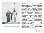
This culture is characterized by a burial mound type. Most of the burial mounds were looted in pre-revolutionary times. Mounds were erected in sacred places in bulk up to 10 meters in height and kings or priests were buried there. Land was brought from the entire adjacent territory of the tribal union. The higher the rank, the higher the mound. The burials were graves with an area of 30 square meters and a depth of 1.5 meters from ground level. Inside the graves, traces of a powerful wooden structure consisting of 9 pillars were found. In one of the mounds the remains of male and female burials were preserved. It is difficult to say whether it was the king’s wife or a concubine. The corpses lay on their backs with their arms extended along their torsos. The king's clothes were decorated with hundreds of gold stripes; he had expensive weapons, a cooking pot, equipment for a war horse, iron darts, and iron swords. Products made of gold and silver. Particularly noteworthy is a silver rhyton - a drinking vessel in the shape of a horn and a Greek-made amphora for storing wine, which are now kept in the Moscow and Belgorod museums of local history.
From 1964 to 1989, under the leadership of Doctor of Historical Sciences, Professor Pyotr Dmitrievich Liberov, a group of Moscow archaeologists conducted excavations near the village of Verbnoye. The need for excavations was caused by the fact that many historians doubt the population that lived in our area in the 1st century BC. Some archaeologists believe that the Middle Don region was inhabited by Scythians. Others are of the opinion that the Budins - Gelons - the ancestors of the early Slavic peoples, who led a more sedentary lifestyle, lived here.
Conclusion: we can confidently say that in the early Iron Age, people lived in our region who established close trade ties with the Greek colonies of the Black Sea region, and archaeological finds testify to this.
Guys, near the village of Novoukolovo there are 15 mounds that are waiting for their researchers. And if any of you express a desire in the future, we can become an organizer or participant in further study of the historical past of our region.
Guys, we've been traveling a lot, but it's time to return home. Let's close our eyes again, remember everything we learned in class, imagine a time machine and return home to the 21st century. Let's start the countdown 3,2,1. We were back in the classroom.
Let's turn to vocabulary for our lesson:
Parking- a settlement of primitive people.
Neanderthals - people who lived in our region 100 thousand years BC.
Flint - a stone used by primitive people to make tools.
Ceramics is the first artificial material created by man.
Scythians - the general name of the main Iranian-speaking population of the Black Sea steppes in the 1st millennium BC.
Scraper - a device used for dressing animal skins (similar to a knife).
Bronze - an alloy of tin and copper.
2. Consolidation. And now we will find out who was attentive in the lesson.
1. When did the first people appear in our area? What were they called?
2. How did Stone Age people get their food?
3. What cultures marked the Bronze Age in our region?
Where did the names of these cultures come from?
4. What do you know about the life of the Scythians?
5. Where on the territory of our region were burial mounds discovered?
6. The first artificial material created by man?
7. How many millennia have passed since people appeared in our region? (100000+2011=102011 years)
Solve the crossword puzzle.
Game "Confusion". Each team is given an envelope with the names of activities, tools, and dates. The first team must select and place on the board everything that relates to primitive people, and the second - to the Scythians.
3. Homework. Prepare a presentation or message on the Scythian culture. At students' choice.
4. Summing up the lesson. What new and interesting things did you learn in class today?
Reflection.
What new did you learn at the museum lesson?
What do you remember most?
What task did you complete in class with great interest?
What difficulties did you encounter?
6. Lesson summary. We will ask our guests to summarize the work.
Introspection of a museum lesson.
Teacher Lesunova V.N.
A museum lesson can be conducted both as part of a general education program in the subject, and as an extracurricular activity. The museum lesson is designed to expand and give additional knowledge to students on the history, culture and nature of their native land, taking into account their age characteristics.
In this case, it can be considered as an extracurricular activity on the history of the native land within the framework of the period studied by 5th grade students.
Museum lesson topic: "Native land in ancient times"Goal: to introduce students to the ancient history of their native land, to prove that people lived in our places during the Stone, Bronze and Iron Ages, to demonstrate museum exhibits that testify to the presence of people in our region.
Educational: - develop the cognitive activity of students, promote the development of interest in the history of the Fatherland and native land;- promote the development of creative imagination in children;- strengthen the skills of counting years in history.Educational: - to cultivate a sense of patriotism and love for one’s small Motherland;- cultivate love and respect for the cultural heritage of your regionForm: Journey into the pastMethods and techniques used in the lesson: verbal: story, conversation, explanation, “immersion in the past”;visual: demonstration of existing museum exhibits, illustrations, drawings, work with a historical map;technical training aids: multimedia projector, computer.Equipment: multimedia projector, computer, museum exhibits, drawings, historical map. Preparatory work: - research activities on the topic of the lesson with strong students;- preparation of presentation;- a selection of museum exhibits for the lesson;- designing visuals for the lesson (making a time line, stops);- organizing an exhibition of books on the history of the Belgorod region.During the classes:
- Organizing time.
I updated the students’ knowledge and set the mood for further work. She offered to travel back in time.
2. At the first stop, “The Site of Primitive Man,” I checked the schoolchildren’s homework: to repeat the topic of life of primitive people. In order to immerse children in the era of antiquity and rely on children’s existing knowledge of this period.
I tried to select simple questions that children could understand. Used visual elements.
In the process of studying new material, I tried to realize the main goal of the lesson and provide evidence that people lived in our region at different stages of its development - to prove this with museum exhibits. I tried to correlate the finds of museum exhibits with the area where they were discovered.
I used elements of research work that Nastya and Alyosha demonstrated.
Organized work with lesson terms.
During consolidation tested the knowledge acquired by the children in the lesson in the process of frontal testing, consolidated the skills of counting years in history. Organized individual work - solved a crossword puzzle. Group work – During the game “Confusion”.
Homework is differentiated. Strong students - With leave a crossword puzzle of 5-6 words on the topic “Scythians”. For the weak, complete test tasks.
Reflection is aimed at finding out whether the children liked this form of organizing the lesson, what stages of the lesson aroused interest, and where difficulties arose.
The settlement of our region by humans began in the final period of the ancient Stone Age - the Paleolithic. About a thousand years ago, the Mesolithic period (Middle Stone Age) began. In our region, the glacier was melting. The Arctic climate changed to a more temperate one, and the territory of the region was covered with dense forests.
The rich vegetation attracted not only reindeer to these areas, but also wild boars, elk, and aurochs, so primitive people could hunt. In addition, they were engaged in fishing, gathering, and hunting waterfowl. People used spears and darts as weapons. Then a hatch and arrows appeared. Fishing was of great importance in farming. They fished with a harpoon, then nets, wicker tops, and fish hooks appeared. Dugout canoe boats appeared.

In the middle of the fifth millennium BC. e. The Mesolithic was replaced by the Neolithic (New Stone Age). The formation of the Baltic Sea coastline has been completed. The people who inhabited the territory of our region began to master more progressive methods of economic activity. There was a transition from appropriating to producing - agriculture and cattle breeding. During the Neolithic period, intertribal contacts intensified, intertribal exchange began first, and then the local population gained the opportunity to establish relations with neighboring groups of tribes, with tribes in more distant territories. Amber was the exchange material in our region. * In return, local tribes received flint raw materials and other necessary materials and products.

A feature of the development of our region in the Bronze Age (mid-2nd millennium BC - 5th century BC) was the invasion of the Baltic territory by nomadic tribes, who, along the Vistula River basin, penetrated into the Eastern Baltic and subsequently populated the forest zone of Eastern Europe from the Baltic Sea to the upper reaches of the Volga. They are called Baltoslavic Indo-European tribes. With the beginning of the Iron Age (from the 5th century BC), the Baltoslavic tribes were divided into Balts and Slavs. At the turn of our era, the period of the ancient history of our region practically ended.

The beginning of the ancient history of the region One of the first to report about the Land of Amber was the Greek scientist and navigator Pytheas. In the 9th century BC e. he visited the mouth of the Vistula. According to him, one day's journey from this mouth lay the skeleton of Abalus, onto the shores of which waves during spring storms threw amber out of the sea. Local residents used this amber as fuel and sold it to Germanic tribes.

Another Greek, Eratosthenes of Cyrene, about a hundred years after Pytheas, depicted the southern part of the Baltic coast in his work Geography. The Romans also began to describe the ancient territories of our region. In the first centuries of the new era, the Romans used amber jewelry very popularly. They managed to organize the Amber Trade Route, which led from Rome to the mouth of the Vistula, where the amber collected by the Baltic tribes on the coast of their sea flocked.

The first scientist of the ancient world who reliably knew about the existence of the Baltic Sea and the territory where amber was collected was Gaius Pliny Secundus, better known as Pliny the Elder. He wrote “Natural History”, in which he included a story about the trip of Nero’s envoy to collect amber to decorate the podium at the gladiatorial games. Analyzing Pliny's text, scientists came to the conclusion that the Roman envoy managed to get to the mouth of the Vistula, which in those distant times flowed not into the Baltic Sea itself, but into the current Vistula Lagoon.

It was possible to present a very accurate geographical picture of the south-eastern Baltic region with everyday details at the turn of the 1st-2nd centuries AD. Cornelius Tacitus, Roman writer and historian. Talking about the tribes on the right bank of the Svevian Sea, he mentioned the Aestians, who created a culture that became the predecessor of the Prussian culture on the territory of our region.

The ancient Greek scientist Claudius Ptolemy, a contemporary of Tacitus, presented a description of the boundaries of the territory of the south-eastern Baltic in his Geography. He called this land European Sarmatia, which was limited in the north by the Sarmatian Ocean and from the mouth of the Vistula extended east to the Western Dvina River.

Around the years The traveler Wulfstan, who sailed across the Baltic Sea from Schleswig to the Vistula Lagoon, described the vast land of Estland, in which there were many settlements, each of them was headed by a leader, and they often fought among themselves. In the middle of the 10th century. The Arab trader Ibrahim ibn Yaqub visited our area and left a message about the life and way of life of the local population. A more detailed description of the ancient Prussian land, the life and customs of its inhabitants at the turn of the century. compiled by the chronicler of the Teutonic Order, Peter of Dusburg.

THANK YOU TO KONSTANTIN IGOREVICH AND STUDENTS FOR YOUR ATTENTION =)