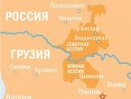
Satellite map of Stavropol Territory. Stavropol Territory on the map of Russia Road map of Stavropol Territory
Maps of the cities of Stavropol Territory: Stavropol | Kislovodsk
Detailed map of the Stavropol Territory with all cities and villages
On the territory of the Russian Federation there is one of the most remarkable beauty places, it is called the Stavropol Territory. The local population according to the latest census data is 3 million people. National composition - Ukrainians, Abaza, Karachais, Dargins, Russians, Armenians and many other nationalities.
The detailed map of the Stavropol Territory with all cities and villages clearly shows the boundaries of the region. The administrative center is Stavropol. Once upon a time this ecologically clean place bore the name of the famous revolutionary Sergo Ordzhonikidze. Then it was part of the autonomous Kizlyar district. Then it was renamed to the name that it still bears.
The territorial and administrative division is carried out into resort and workers' settlements, cities of regional subordination, villages and other settlements. The economy is provided by the electric power industry, mechanical engineering, food, chemical, furniture, microbiological industries. You can always find the largest GRES and TPPs on a detailed map of the Stavropol Territory with settlements. Agriculture is well developed. The leading role is assigned to fine-wool sheep breeding, pig breeding, beekeeping, poultry farming, sunflower and grape growing.
Districts of the Stavropol Territory on the map:
Car roads
On the satellite map of the Stavropol Territory, it is clear that there are relatively few major highways in the region. In the Stavropol region, there are five federal highways:
- - highway P216: a highway connecting Stavropol (Stavropol) with Kalmykia (Elista) and the Astrakhan region (Astrakhan);
- - the federal highway "Caucasus" (P217), a 1,100-kilometer highway running from the Krasnodar Territory (village Pavlovskaya) to the border with Azerbaijan (Yarag-Kazmalyar) through Tikhoretsk, Grozny, Armavir and Makhachkala;
- - 75-kilometer federal highway A165, going from Lermontov in Stavropol region to the Karachay-Circassian capital, Cherkessk;
- - federal highway A167 connecting Kochubey with Mineralnye Vody and passing through Zelenokumsk and Neftekumsk;
- - 46-kilometer federal highway A157, leading from the airport of Mineralnye Vody to Kislovodsk and passing through Essentuki.
Railways
If you look at the Stavropol Territory on the map of Russia, you can see that the subject is covered by the network of the North Caucasian Railway. It is part of the Mineralvodovsky region of the North Caucasus Railway.
Map of Stavropol Territory with cities and villages
On the map of the Stavropol Territory with regions, you can count more than a quarter of a hundred cities and towns and over seven hundred rural settlements. The population of five cities exceeds 100 thousand people: Stavropol (more than 400 thousand), Pyatigorsk, Essentuki, Nevinnomyssk and Kislovodsk. The population of the remaining twenty cities and towns varies from 17 to 87 thousand people.
→ Stavropol Territory
Detailed map of Stavropol Territory
| Stavropol Territory on the map of Russia. Detailed map of Stavropol Krai region with cities and villages. Satellite map of Stavropol Territory with areas, villages, streets and house numbers. Explore detailed maps from the satellite services "Yandex Maps" and "Google Maps" online. Find the required address, street or house on the map of Stavropol Krai. Zoom in or out on the map using mouse scrolling or touchpad gestures. Switch between schematic and satellite maps of Stavropol Krai. |
Map of Stavropol Krai with cities, districts and villages
| 1. | 10. () | 19. | 28. () |
| 2. () | 11. () | 20. | 29. () |
| 3. () | 12. () | 21. () | 30. () |
| 4. () | 13. () | 22. | 31. () |
| 5. () | 14. () | 23. | 32. () |
| 6. () | 15. () | 24. | 33. () |
| 7. () | 16. () | 25. | 34. () |
| 8. () | 17. () | 26. () | |
| 9. () | 18. () | 27. () |
Satellite map of Stavropol Territory
Switching between the satellite map of the Stavropol Territory and the schematic is done in the lower left corner of the interactive map.
Stavropol Territory - Wikipedia:
Population of Stavropol Krai: 2 800 551 people
Telephone codes of the Stavropol Territory:865, 879, 863.
Stavropol Territory Square:66 160 km²
Car codes of the Stavropol Territory: 26
Districts of the Stavropol Territory:
Alexandrovsky Andropovsky Apanasenkovsky Arzgirsky Budennovsky Grachevsky Kochubeevsky Krasnogvardeisky Kursk Levokumsky Novoselytsky Foothill Stepnovsky Trunovsky Turkmen Shpakovsky.
Cities of Stavropol Krai - list of cities in alphabetical order:
City Grateful founded in 1782. The population of the city is 31,293 people.
City of Budennovskfounded in 1799. The population of the city is 62,715 people.
Georgievsk city founded in 1777. The population of the city is 69,030 people.
Essentuki city founded in 1825. The population of the city is 107104 people.
Zheleznovodsk founded in 1810. The population of the city is 25203 people.
Zelenokumsk founded in 1781. The population of the city is 35 646 people.
City Abundant founded in 1895. The population of the city is 38263 people.
Ipatovo town founded in 1860. The population of the city is 24390 people.
Kislovodsk city founded in 1803. The population of the city is 129,861 people.
Lermontov city founded in 1953. The population of the city is 22477 people.
Mineralnye Vody city founded in 1878. The population of the city is 75381 people.
Mikhailovsk city founded in 1784. The population of the city is 87916 people.
City of Nevinnomyssk founded in 1825. The population of the city is 117676 people.
City of Neftekumsk founded in 1958. The population of the city is 24841 people.
Novoaleksandrovsk city founded in 1804. The population of the city is 27009 people.
Novopavlovsk city founded in 1777. The population of the city is 26234 people.
Pyatigorsk city founded in 1780. The population of the city is 145,836 people.
City of Svetlograd founded in 1786. The population of the city is 36935 people.
Stavropol city founded in 1777. The population of the city is 433,577 people.
Stavropol region - a region of Russia that occupies the territory of the northern slope of the Greater Caucasus. Regional center - city Stavropol... Many large rivers flow through the region - Kuma, Terek, Yegorlyk and others.
The historical and cultural potential of the region is undeniable. Many attractions of the region are under state and federal protection. In total, there are more than 2000 thousand monuments in this region. Many cities in the region received the status of historical - Pyatigorsk, Kislovodsk, Stavropol, etc.
The Stavropol Territory is associated with the name of the famous poet Lermontov. The main attractions associated with this famous surname are Lermontovsky waterfall, Lermontovskaya rock, etc.
Attractions of the Stavropol Territory: Lake Vshivoe, Failure, Grozny, Temple of Nicholas the Wonderworker, Dagger, Mangy, Strizhament, Bull, Honey, Beshtau, Mashuk, Temple of the Kazan Icon of God Iron, Shaved, Golden Kurgan, Breakup, Kabanka, Morgun, Snake Mountain, Hot Mountain and Mashuk, Grotto of Diana and Lermontov, Palace of the Emir of Bukhara in Zheleznovodsk, Valley of Roses in Kislovodsk, Castle of Treachery and Love, Kislovodsk Resort Park, Ring Mountain, Resort Park in Essentuki, Honey Waterfalls in Kislovodsk, Place of Lermontov's Duel, Narzan Gallery in Kislovodsk, Kislovodsk Narzan Gallery road, Cathedral of the Intercession of the Most Holy Theotokos, Healing springs of Zheleznovodsk.
Stavropol Territory is a region of the Russian Federation located in the central part of the Ciscaucasia. The satellite map of the Stavropol Territory shows that the region borders on Dagestan, Rostov Region, Kalmykia, Krasnodar Territory, North Ossetia-Alania, Kabardino-Balkar, Karachay-Cherkess and Chechen Republics. The area of \u200b\u200bthe region is 66 160 sq. km.
The economy of the Stavropol Territory largely depends on the production of oil, gas and gas condensate. The main industries are mechanical engineering, food and chemical industries, and electric power. The region also has developed agriculture and extraction of geothermal waters. The mineral waters of the region are widely known, in particular, Narzan.
The region is divided into 26 districts, 11 cities of district and 10 cities of regional subordination, 18 resort and workers' settlements. The largest cities of the Stavropol Territory are Stavropol (center), Pyatigorsk, Kislovodsk, Nevinnomyssk and Essentuki.
Region "Caucasian Mineral Waters"
Brief history of the Stavropol Territory
In 1847, the Stavropol province was formed. In 1924 it was transformed into the North Caucasian Territory. In 1936, the North Caucasian Territory was reorganized, and the Ordzhonikidze Territory was separated from it with the center in the city of Stavropol. In 1943, the Ordzhonikidze Territory was transformed into the Stavropol Territory.

Mud bath in the city of Essentuki
Attractions of the Stavropol Territory
On a detailed map of the Stavropol Territory, you can see that there are 4 resort cities in the region: Essentuki, Kislovodsk, Zheleznovodsk and Pyatigorsk, which are part of the Caucasian Mineral Waters resort area. We recommend you to relax in the sanatoriums and hospitals of the Stavropol Territory.
It is recommended to visit such sights of the Stavropol Territory as Mount Mashuk, Honey Waterfalls in the Alikon Gorge, Kislovodsk Fortress, Birch Gorge with karst caves, the Tatar Settlement Museum and the M.Yu. Lermontov.
Tourist notes